


Voting District SALM, Granville County, North Carolina
About
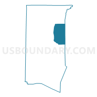
Outline

Summary
| Unique Area Identifier | 640184 |
| Name | Voting District SALM |
| County | Granville County |
| State | North Carolina |
| Area (square miles) | 35.77 |
| Land Area (square miles) | 35.61 |
| Water Area (square miles) | 0.16 |
| % of Land Area | 99.54 |
| % of Water Area | 0.46 |
| Latitude of the Internal Point | 36.37375840 |
| Longtitude of the Internal Point | -78.54823520 |
Maps


Graphs
Select a template below for downloading or customizing gragh for Voting District SALM, Granville County, North Carolina


Neighbors
Neighoring Voting District (by Name) Neighboring Voting District on the Map
- Voting District ANTI, Granville County, NC
- Voting District CRDL, Granville County, NC
- Voting District DABN, Vance County, NC
- Voting District EAOX, Granville County, NC
- Voting District SASS, Granville County, NC
- Voting District WATK, Vance County, NC
- Voting District WMSB, Vance County, NC
- Voting District WOEL, Granville County, NC
Top 10 Neighboring County Subdivision (by Population) Neighboring County Subdivision on the Map
- Fishing Creek township, Granville County, NC (8,169)
- Oxford township, Granville County, NC (7,425)
- Williamsboro township, Vance County, NC (3,332)
- Sassafras Fork township, Granville County, NC (2,831)
- Dabney township, Vance County, NC (2,818)
- Salem township, Granville County, NC (1,884)
- Watkins township, Vance County, NC (640)
Top 10 Neighboring Place (by Population) Neighboring Place on the Map
Top 10 Neighboring Unified School District (by Population) Neighboring Unified School District on the Map
Top 10 Neighboring State Legislative District Lower Chamber (by Population) Neighboring State Legislative District Lower Chamber on the Map
Top 10 Neighboring State Legislative District Upper Chamber (by Population) Neighboring State Legislative District Upper Chamber on the Map
Top 10 Neighboring 111th Congressional District (by Population) Neighboring 111th Congressional District on the Map
Top 10 Neighboring Census Tract (by Population) Neighboring Census Tract on the Map
- Census Tract 9701.01, Granville County, NC (5,273)
- Census Tract 9603, Vance County, NC (5,151)
- Census Tract 9702, Granville County, NC (4,270)
- Census Tract 9602, Vance County, NC (4,170)
- Census Tract 9704, Granville County, NC (4,040)
- Census Tract 9705, Granville County, NC (3,839)